utilizing satellites for accurate assessment of climate impacts worldwide
The Role of Satellites in Climate Monitoring
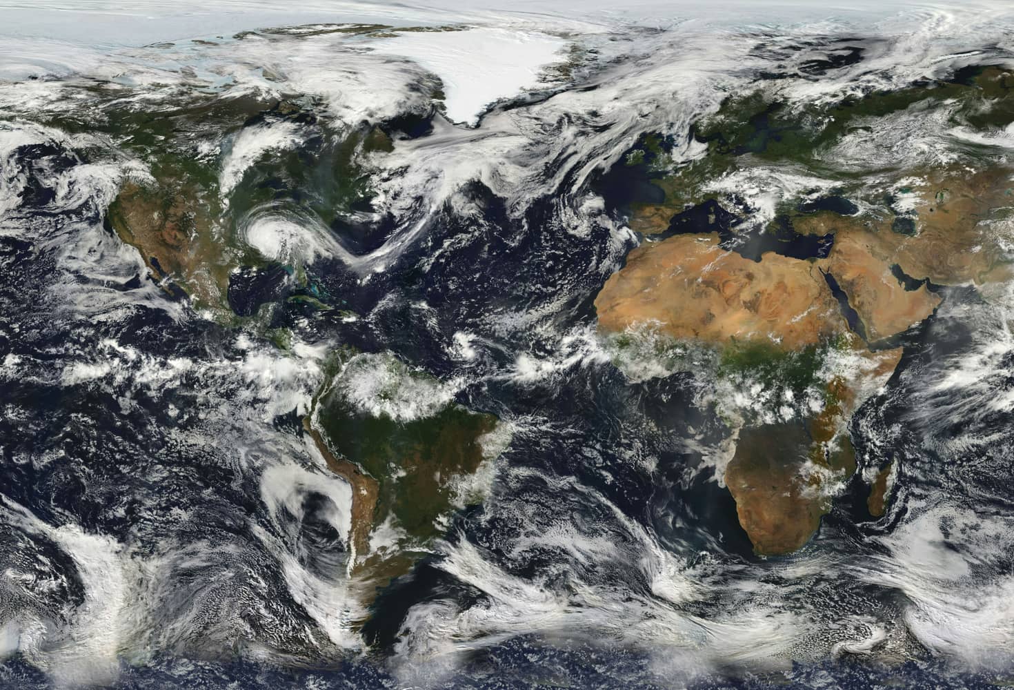
Satellites have become indispensable tools in the field of climate science, providing vital data that helps scientists track and understand environmental changes across the globe. These sophisticated machines orbit the Earth, capturing images and collecting data on a wide range of factors, from atmospheric temperatures to sea level rise, playing a crucial role in monitoring and mitigating the effects of global warming.
How Satellites Collect Climate Data
Satellites gather climate data through a variety of sensors and instruments. These include:
- Radiometers: Measure the intensity of electromagnetic radiation emitted by Earth and its atmosphere.
- Lidar: Utilizes laser light to analyze the composition and behavior of the atmosphere, such as cloud cover and aerosol levels.
- Spectrometers: Break down light into different wavelengths to study gases and other atmospheric constituents.
- Altimeters: Measure altitude or sea surface height, critical for assessing ocean currents and sea level changes.
This data is transmitted back to Earth, where it is processed and analyzed by researchers to identify trends and anomalies in climate patterns.
Notable Satellite Missions and Their Contributions
Landsat Program
The Landsat Program, launched in 1972, is one of the most long-standing satellite missions dedicated to Earth observation. Managed jointly by NASA and the US Geological Survey, it provides high-resolution images of the planet's surface, enabling scientists to monitor changes in land use, deforestation, and urban expansion.
COPERNICUS Sentinel Satellites
The European Union's Copernicus program operates a constellation of Sentinel satellites, each with specific missions. Sentinel-1, for example, uses radar imagery to monitor oil spills and sea ice movements, while Sentinel-2 captures optical images for agricultural and forestry management. Together, they offer a comprehensive view of environmental dynamics.
NASA's Aqua and Terra Satellites
Aqua and Terra are part of NASA's Earth Observing System (EOS) and are equipped with multiple sensors like MODIS (Moderate Resolution Imaging Spectroradiometer). These satellites collect data on a wide array of climate indicators, including sea surface temperature, solar radiation, and phytoplankton levels, essential for understanding global carbon cycles.
Analyzing Satellite Data to Understand Climate Change
Once collected, satellite data undergoes extensive processing to extract meaningful insights. This involves several key steps:
- Data Validation: Ensuring the accuracy of data through cross-referencing with ground-based observations.
- Data Analysis: Employing advanced algorithms to detect patterns and anomalies in climate parameters.
- Modeling and Simulation: Using statistical models to simulate future climate scenarios based on historical data trends.
Real-world Applications
Satellite data has been pivotal in revealing critical insights about Earth's climate system. For example, satellite imagery has confirmed significant reductions in Arctic sea ice extent over recent decades, highlighting the urgent need for policies addressing greenhouse gas emissions. Moreover, satellites have been instrumental in monitoring phenomena like El Niño and La Niña, which significantly influence global weather patterns.
Challenges in Satellite Climate Monitoring
Despite their potential, satellites face limitations that can affect the accuracy of climate assessments:
- Temporal Resolution: Some satellites may only pass over the same location once every few days, potentially missing short-term events.
- Spectral Resolution: Limited ability to distinguish between certain wavelengths can constrain data quality.
- Technical Malfunctions: Instrument failures can disrupt data collection and require costly repairs or replacements.
Overcoming these challenges requires ongoing technological advancements and international collaboration.
The Future of Satellite-Based Climate Monitoring
Innovations on the Horizon
Emerging technologies promise to enhance satellite capabilities further. Hyperspectral imaging will offer more detailed data by covering a broader range of wavelengths. Additionally, small satellites or CubeSats are set to revolutionize data collection with their cost-effective deployment and ability to form large constellations for near-real-time monitoring.
International Collaboration
Tackling global climate change demands coordinated efforts. Initiatives like the Global Earth Observation System of Systems (GEOSS) aim to integrate satellite data from multiple countries, providing a unified platform for sharing critical information. This collaboration ensures more accurate and comprehensive climate assessments worldwide.
In conclusion, satellites are invaluable assets in the fight against climate change, providing essential data that informs policy decisions and guides mitigation strategies. As technology evolves, their role will continue to expand, offering even greater insights into our planet's complex climate system.